1:2 Ponds
1:2 Ponds
What do we do in the de Ponds team?
We study the ponds in the high mountain areas of Sierra Nevada, as they are outstanding sensors of global change.
The specific features of these water bodies set them apart from other alpine pond systems and make them natural laboratories for research on the effects of global change.
This is what we do in our research:
- Evaluate the ecological status of ecosystems and detect natural or anthropic changes. We take samples from the ponds periodically and characterize their physicochemical and biological conditions.
- Study how ecosystems and their organisms respond to stress factors, such as temperature rises, increases in nutrients due to Saharan dust, ultraviolet radiation, CO2 or microplastics, among others. To achieve this goal, we perform in situ experiments using enclosures called mesocosmos where we simulate future scenarios of global change.
What did we find out?
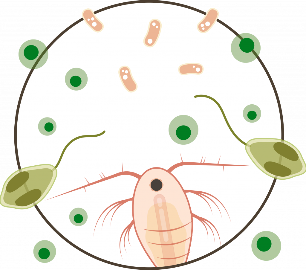
We study the multiple factors that disrupt the ecological status of ponds in the high mountain areas.
The increase in temperature modifies the relationships between algae and non-photosynthetic organisms, such as bacteria and zooplankton, and this may alter balances in food webs.
Ultraviolet radiation is detrimental to algae, as it reduces their photosynthetic capacity and hampers their growth. Nevertheless, some algae are adapted to this detrimental radiation and to nutrient scarcity through a mixed feeding system known as “mixotrophy”. Some mixotrophic species, such as Chromulina nevadensis, do their photosynthesis and additionally feed on bacteria. This helps them make up for the harmful effects of ultraviolet radiation and nutrient scarcity.
Nevertheless, the increases in temperature and in the frequency and intensity of the haze episodes from the Sahara currently pose a threat to mixotrophic species. Saharan dust provides nutrients that certain species of green fast-growing algae, such as Dictyosphaerium chlorelloides, may take advantage of. Consequently, mixotrophic algae are displaced by the massive growth of green algae, which reduces the taxonomic and functional biodiversity of ecosystems.
Mountain ponds are not immune to plastic contamination either. We have detected higher concentrations of microplastics in ponds that are surrounded by meadows called borreguiles (areas with small lakes and peat bogs), which usually receive a larger number of visitors.
Find out how Saharan dust alters the food web in ponds.
How does our work benefit us?
The research performed in these ecosystems enables us to clearly understand how global change is affecting the planet.
By studying these ponds, we may witness the accelerated changes that the mountains are going through. Actually, the loss of biodiversity related to global change is more clearly observed in the mountains, where there are no direct human interferences.
These ecosystems have unique features that turn them into natural laboratories where fundamental aspects of Ecology may be tested, and we can anticipate to what will happen in other latitudes and at lower altitudes.
Our results reinforce the view that those ecosystems that have barely been altered in protected areas play a protective role for human beings.

Data generated by the team
Learn more about the data we are generating- Intensive monitoring of physicochemical data and biological communities in 3 high-mountain lakes.
- Extensive monitoring of physicochemical data and biological communities in 50 high-mountain lakes (Citizen Science).
- Monitoring physicochemical properties in 3 high-mountain lakes.
- Monitoring the Saharan dust deposition effects on the geochemistry and biological communities of 4 high-mountain lakes.
2:2 Rivers
What do we do in the Rivers team?
We promote environmental education by raising awareness on the state of rivers, and we highlight the value of the work carried out by the scientific community
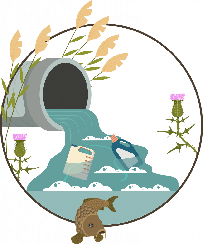
Because of global change, rivers are among the most threatened and vulnerable ecosystems. The headwaters of many rivers are found in mountains, which are the great freshwater reservoirs in the world. Aside from providing downstream towns and villages with water, brooks and mountain rivers also sustain other fragile ecosystems, such as forests and wetlands. Nevertheless, rivers are becoming more and more threatened by human intervention, pollution, and climate change.
In our team, we promote the educational initiative “Rivers for Life”, where pre-university students play the role of an environmental technician. Under professional supervision, they analyse the ecological status of a river by studying its biological, physico-chemical and hydrological characteristics.
Find out how the health of rivers worsens because of human activity.
From the rivers’ sources in the headwaters of glacial valleys in Sierra Nevada, the condition of rivers worsens because of human activity.
Find out how the health of rivers worsens because of human activity.
From the rivers’ sources in the headwaters of glacial valleys in Sierra Nevada, the condition of rivers worsens because of human activity.
Find out how the health of rivers worsens because of human activity.
From the rivers’ sources in the headwaters of glacial valleys in Sierra Nevada, the condition of rivers worsens because of human activity.
Rotate
What are the benefits of our work?
We assess the health of rivers and raise social awareness about its importance.
Water is one of the scarcest and most important natural resources for Andalucía. According to all forecasts, climate change may aggravate such scarcity over the next few years.
Through our actions, we evaluate the quality of rivers and raise people awareness on the importance of this subject. Our aim is to encourage them to adopt behaviours that promote a good condition of rivers. At the same time, we explain the need to adopt more sustainable water management policies.
Data generated by the team
Learn more about the data we are generating- High-frequency temperature data in Poqueira river.
- Monitoring physicochemical data and macroinvertebrate communities in Poqueira river.
Data generated by the team
Learn more about the data we are currently generating- High-frequency temperature data in Poqueira river.
- Monitoring physicochemical data and macroinvertebrate communities in Poqueira river.